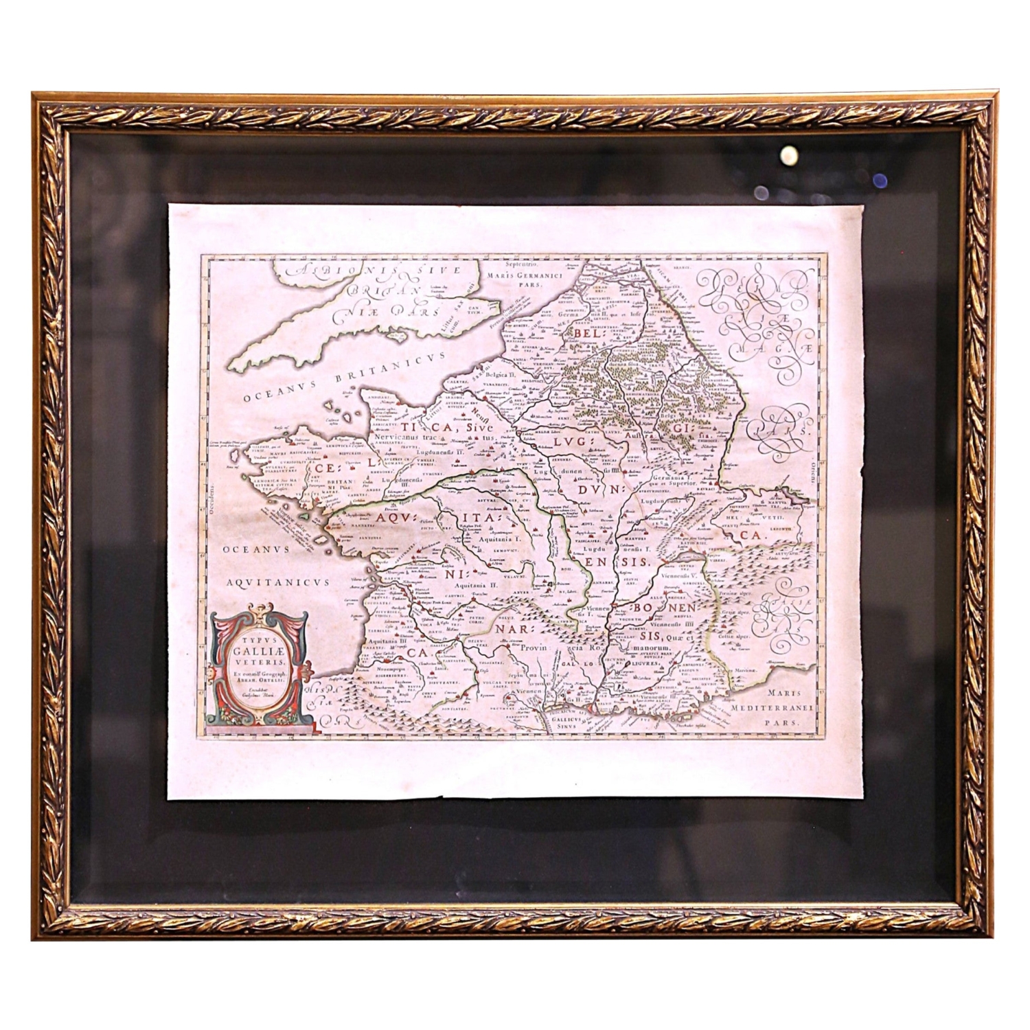
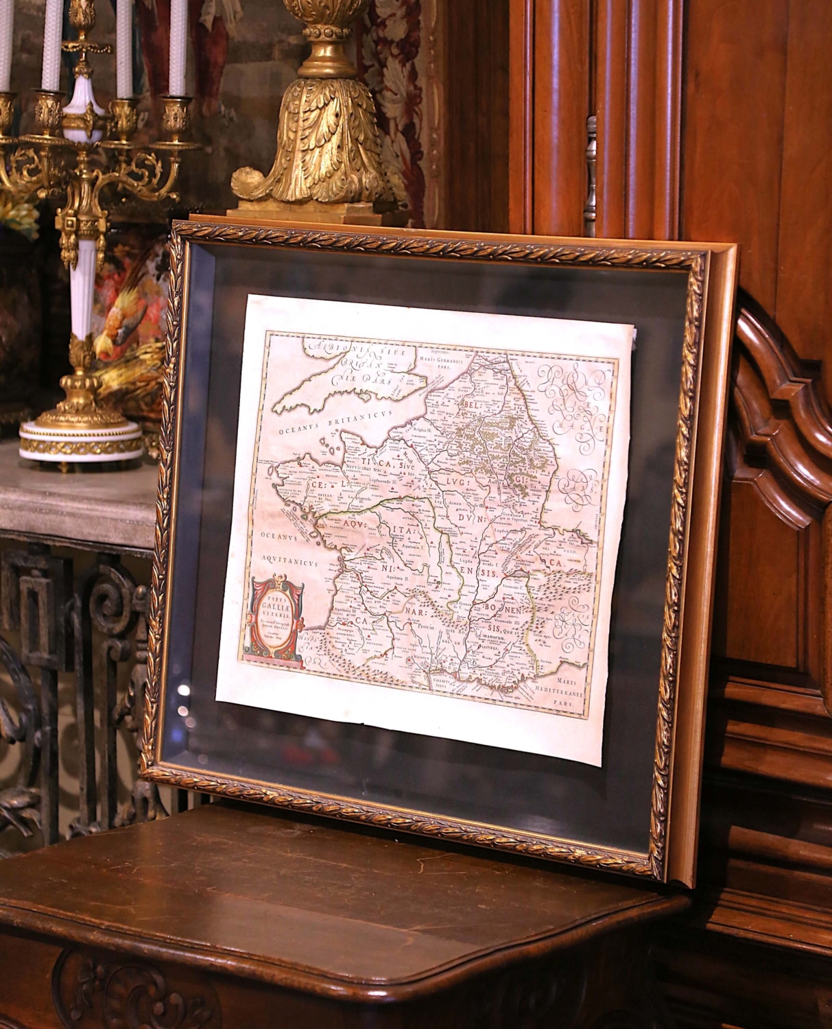
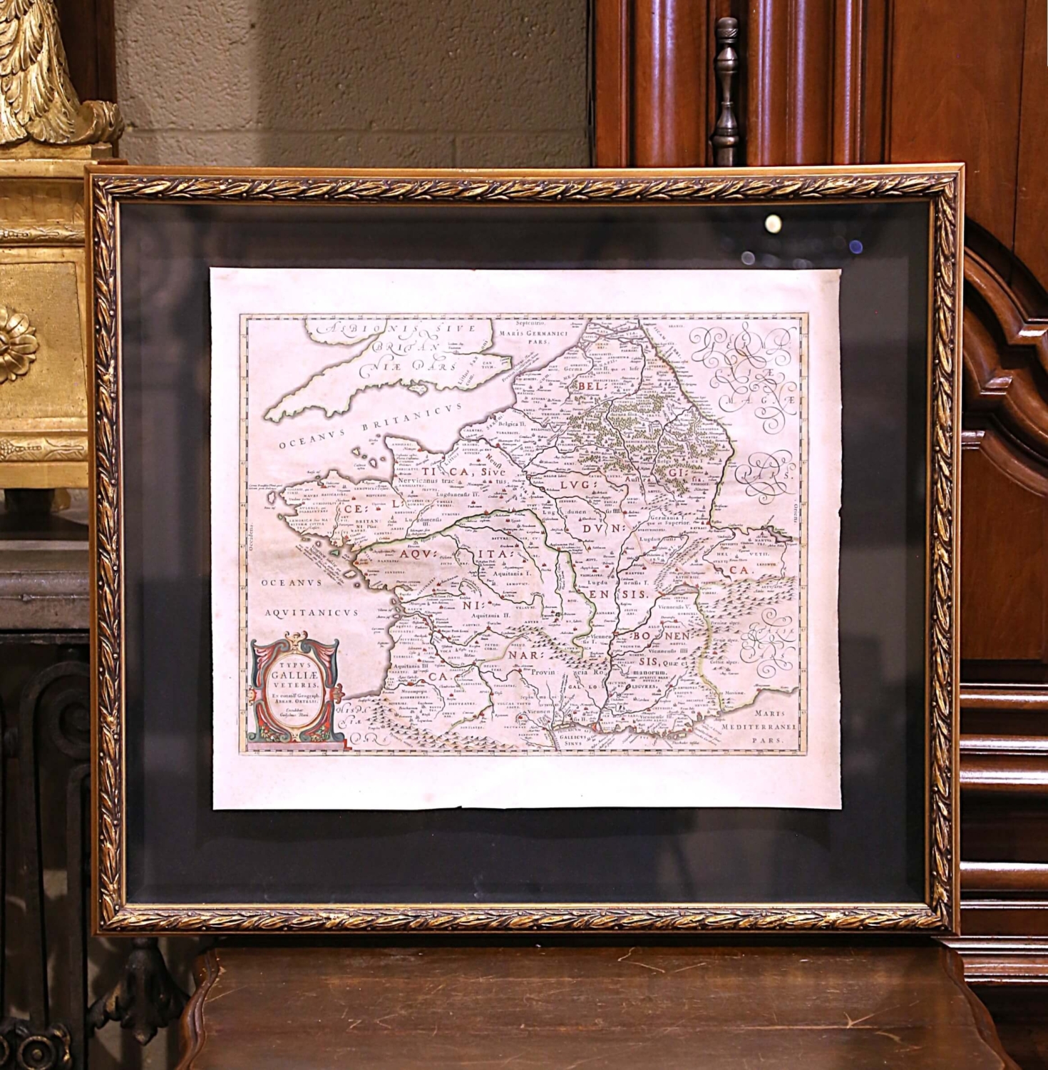
17th Century Framed Map of Ancient France Titled “Typus Galliae Veteris”
$2,800
About
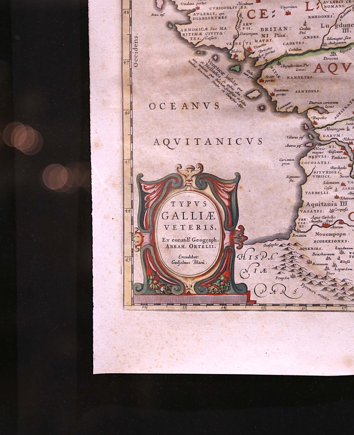
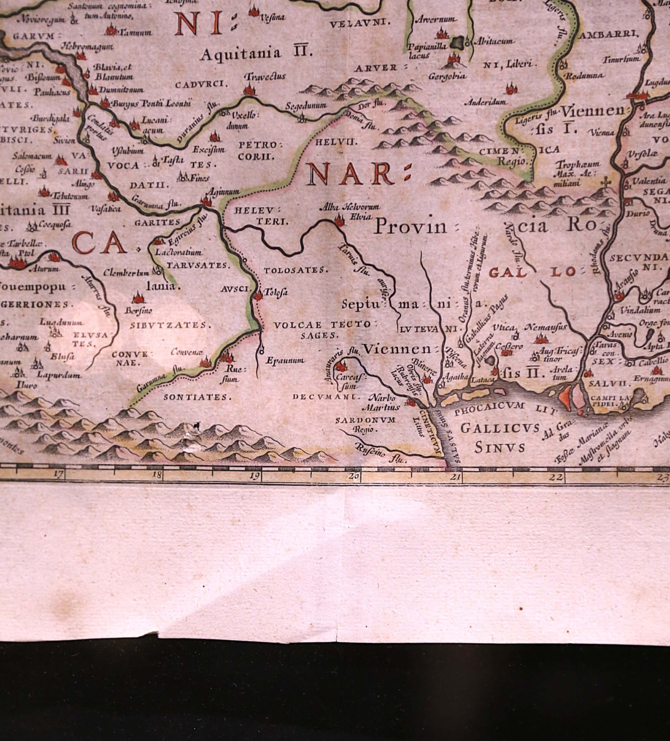
Decorate an office or a library with this elegant historic map. Crafted in the Netherlands circa 1630, this beautifully framed antique map with protective glass, titled “Typus Galliae Veteris”, is a historical representation of Ancient Gaul (modern-day France) during the Roman era. Originally created by the renowned 16th-century cartographer Abraham Ortelius, this map was later published by Guillaume Blaeu, one of the most influential Dutch mapmakers of the 17th century. The map is a fine example of early cartographic artistry, featuring hand-colored regional divisions, intricate geographical details, and elaborate decorative elements. The map depicts the territorial divisions of Gaul as recognized by the Romans, including Aquitania, Lugdunensis, and Belgica, with major settlements and topographical elements such as rivers and mountain ranges carefully outlined. The ornate title cartouche, located in the lower-left corner, is designed in the elaborate Baroque style typical of Ortelius and Blaeu’s maps, adding an artistic flourish to this historical document. The wonderful cartography piece is in good condition commensurate with age and use. Some small tears in the paper and a center crease where it was once apart of a book (see detailed images). Measures: 30.5″W x 27″H
Additional information
| Dimensions | 30.5" W x 2.25" D x 27" H |
|---|---|
| Style | Baroque |
| Period | 17th Century |